
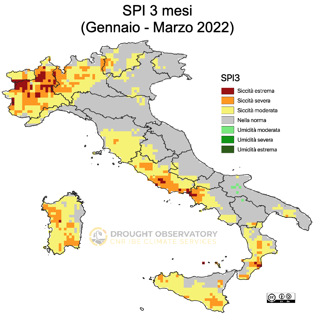
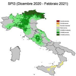
Situazione siccità Marzo 2022
La siccità sul Nord Italia persiste e si estende sul breve periodo anche a diverse aree del centro-sud. Sul lungo periodo il Nord-Ovest e la bassa Padana sono ancora le zone più colpite.

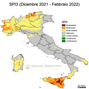
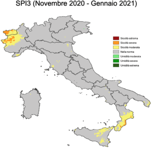
Situazione siccità Marzo 2022
La siccità sul Nord Italia persiste e si estende sul breve periodo anche a diverse aree del centro-sud. Sul lungo periodo il Nord-Ovest e la bassa Padana sono ancora le zone più colpite.
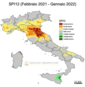
Situazione siccità Maggio 2021
piogge e temperature mensili Dal punto di vista delle precipitazioni Maggio è risultato più secco nelle province di Arezzo, Siena e Grosseto, pressoché nella norma


Open Data
A complete catalogue (CKAN and GeoServer) with data and metadata in different formats and standard protocols. Any third-party client applications can easily reuse the spatial data.

web gis
A customised Open Source WebGIS application to integrate different datasets and share maps of drought indices with researchers, decision makers and other stakeholders.

Monthly Updates
Monthly updates on Tuscan drought current and future conditions and local impacts, press releases and useful links. [The bulletin is issued only in Italian.]

RESTful APIs
RESTFUL APIs for data downloading, clipping and geoprocessing ensure the interoperability.

User Survey
The users’ survey collecting suggestions and needs on drought management and information, so to improve effectiveness of the drought operational services.

Glossary
A selected list of drought related keywords. Sources: EarthLabs, Intergovernmental Panel on Climate Change (IPCC), National Drought Mitigation Center (NDMC).